
Overview
The Global Positioning System (GPS) is a satellite-based navigation system owned by the United States Space Force, one of several global navigation satellite systems (GNSS) that provide geolocation and precise time information to a receiver anywhere on or near Earth's surface where signal quality permits. GPS doesn't require the user to transmit any data and operates independently of telephone or internet connectivity, though those technologies can enhance accuracy and provide supplementary location services in some applications. In aviation, GPS has become a core component of modern navigation, supplementing or in many cases replacing older ground-based navigation aids like VOR beacons for both en-route navigation and, with sufficient augmentation, precision approach guidance. GPS accuracy for aviation use is often enhanced through augmentation systems, such as the FAA's Wide Area Augmentation System (WAAS), which correct for signal errors to provide the higher precision needed for instrument approaches.
History
The US Department of Defense began developing GPS in the early 1970s, initially envisioning it purely as a military positioning and navigation system. GPS became operational through the 1980s and was declared fully operational in 1995, though a deliberately degraded civilian signal, called Selective Availability, initially limited the accuracy available to non-military users. President Bill Clinton ordered Selective Availability discontinued in 2000, dramatically improving civilian GPS accuracy overnight and accelerating GPS adoption across aviation, maritime, and countless other civilian applications. Aviation-specific GPS augmentation systems, such as the FAA's Wide Area Augmentation System, were developed and deployed in the 2000s to provide the higher precision needed for GPS-based instrument approaches, cementing GPS's role as a core pillar of modern aviation navigation.
Design & Specifications
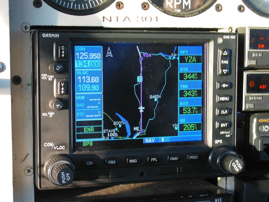
GPS receivers aboard aircraft calculate precise position by triangulating signals from multiple satellites, feeding that data into navigation and autopilot systems.
Operations
Pilots use GPS for en-route navigation and, with appropriate augmentation, for precision approach guidance, supplementing or replacing older ground-based navigation aids.
See also
References
| Category | Navigation, Meteorology & Rules |
| Type | Satellite navigation system |
| Operator | US Space Force |
| Full Civilian Accuracy | Since 2000 (Selective Availability off) |
| Aviation Augmentation | WAAS (US) |